St. George VermontHIKING TRAILS & PLACES TO HIKE
Listed below are the best hiking trails and places to hike near St. George, Vermont.
1. Street Trail
SCENIC OUT AND BACK
Street Trail is an 8.0-mile out and back trail located near Saint George in the High Peaks Wilderness. The trail offers moderate hiking with beautiful Vermont scenery throughout its length. Hikers can enjoy the natural landscapes and wildlife that make this area a popular destination for outdoor enthusiasts.
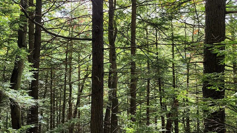
2. Owl's Head Trail
EASY VIEWS WOODLAND PATH
Owl's Head is a 1.5-mile one-way trail in Groton State Forest that provides an easy hiking experience suitable for most skill levels. The woodland path leads to impressive viewpoints that showcase Vermont's natural beauty. This one-hour hike is perfect for families looking for an accessible nature experience with rewarding vistas.
3. Peacham Bog Trail
WOODLAND BOG ADVENTURE
Peacham Bog Trail is a 4.5-mile loop in Groton State Forest that takes hikers through unique woodland and bog environments. The moderate difficulty trail requires approximately 3.5 hours to complete, making it a substantial day hike. Visitors can experience the diverse ecosystem of a northern bog while enjoying the tranquility of Vermont's forests.
4. Camel's Hump Loop
ICONIC VERMONT SUMMIT
Camel's Hump Loop is a 5.5-mile trail that takes hikers to one of Vermont's most recognizable mountain summits. The challenging route rewards hikers with panoramic views of the Green Mountains and surrounding landscape. This iconic Vermont hike showcases alpine zones and diverse forest environments on the way to the distinctive humped summit.
5. Falls of Lana
CASCADING ROCK FORMATIONS
The Falls of Lana trail leads to a spectacular series of cascading waterfalls carved out of rock formations. Hikers can enjoy moderate terrain while approaching these impressive natural water features. The trail offers a refreshing destination, especially during spring runoff when the falls are at their most dramatic.
6. Rattlesnake Point
PEREGRINE FALCON VIEWPOINT
Rattlesnake Point trail leads to a notable area known for its breeding peregrine falcons and impressive vistas. The moderate hike rewards visitors with stunning views of Lake Champlain and the Adirondack Mountains. Nature enthusiasts may spot the majestic peregrine falcons that make this area their nesting grounds during certain seasons.
7. Kingdom Heritage Trail
IMMERSIVE WORKING FOREST
The Kingdom Heritage Trail stretches 20 miles from Island Pond to Lewis Pond Overlook in the Silvio O. Conte National Wildlife Refuge. This moderate to advanced trail system traverses Bluff, Middle, and Gore Mountains through a protected working forest. Opened in 2019 after two decades of collaboration, the trail is part of a 132,000-acre conservation effort formerly owned by Champion International Paper.
8. Bluff Mountain Community Trail
PANORAMIC MOUNTAIN VIEWS
Bluff Mountain Community Trail is a moderate 1.2-mile path leading to a summit with spectacular views. Hikers can see Burke Mountain and East Mountain from the top, offering some of the best panoramas in the Northeast Kingdom. The relatively short distance makes this an accessible hike for those seeking rewarding views without an all-day commitment.
9. Osmore Pond Hiking Loop
SERENE WOODLAND LAKESIDE
Osmore Pond Hiking Loop is a 2-mile trail that circles a picturesque pond in Groton State Forest. The easy difficulty level makes it accessible for hikers of all abilities, requiring approximately two hours to complete. Combining woodland and lakeside environments, this trail provides a peaceful nature experience with beautiful water views.
10. Mt. Marcy via Van Hoevenberg Trail
HIGHEST ADIRONDACK PEAK
Mt. Marcy via Van Hoevenberg Trail is a challenging 14-mile route to New York's highest peak. The trail takes hikers through diverse ecosystems, from hardwood forests to alpine zones above the treeline. Reaching the 5,344-foot summit rewards adventurers with spectacular 360-degree views of the Adirondack Mountains and beyond.